
Other Geographic Locations Maps
State, County, and Point Maps are found in the Distribution Maps tab, but some people are looking for records in other types of geographic areas. Other Geographic Locations Maps contain boundaries for hundreds of thousands of public and private properties and locations and all records with a public point, line, or polygon are compared to those maps.
📘 Instructions
Using the Species Distribution by Other Geographic Locations tool
Select the Country (currently limited to United States and Canada)
Select the State, Province, or Territory
County is not required, but recommended to narrow down the results and make finding the location easier
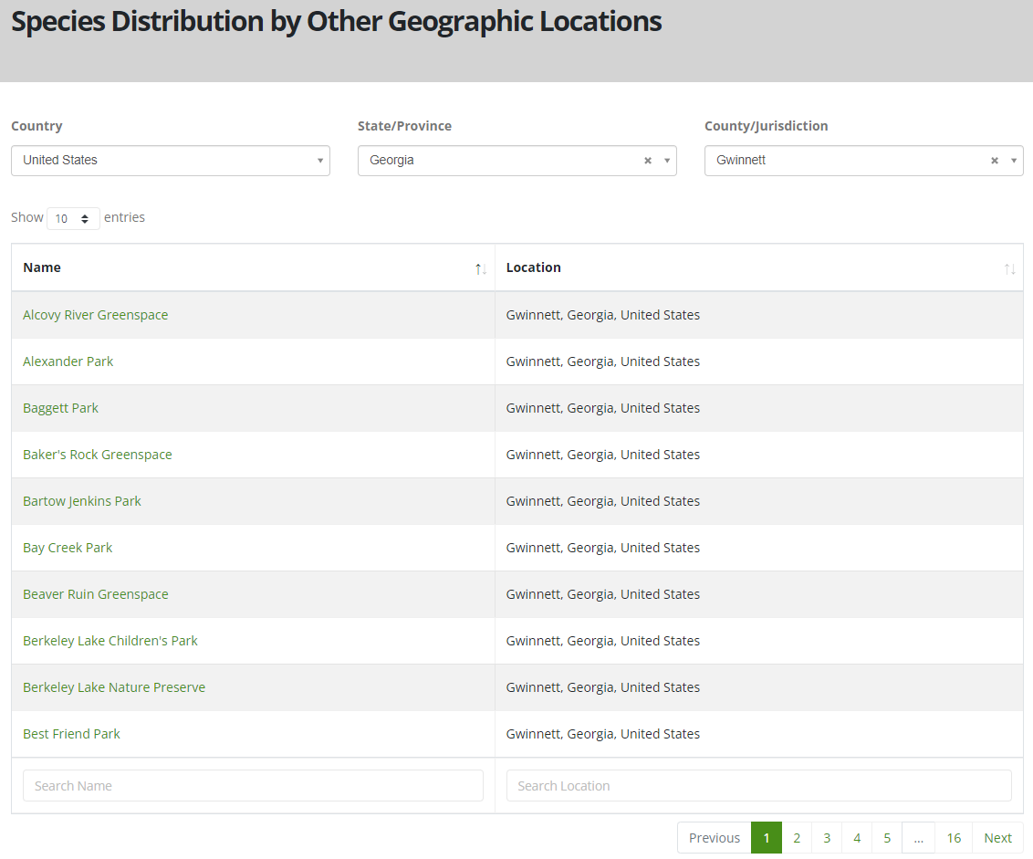
Browse or search for the name of the location or property and click on it
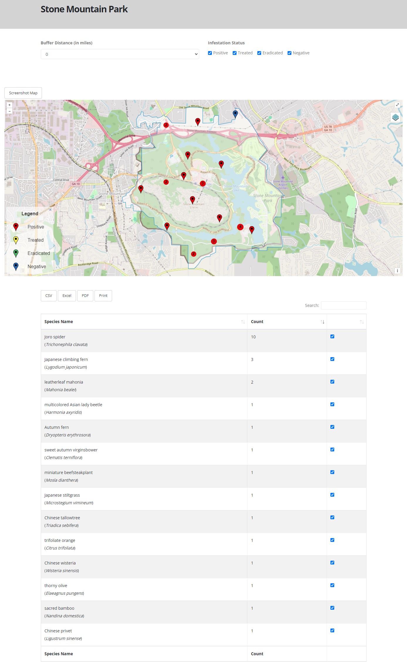
The filters and checkboxes allow you to adjust what shows up on the map and table.
Use the Buffer to extend the area around the boundary to know what is in the nearby area.
Use the Infestation Status check boxes to only return the types of records your are interested in.
Use the check boxes in the table to include or exclude certain records.
Use the Screenshot Map button above the map to download a snapshot of the map.
Use the CSV, Excel, or PDF buttons above the table to download the table or select Print for a paper copy.
If there is a public land we are missing, let us know where to download the shapefile for us to add it as an option.